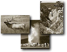
%20of%20mammothareabar.JPG)
Geological Overview
of the Mammoth Area - National
Park Service
Mammoth
Hot Springs are a surficial expression of the deep volcanic forces at
work in Yellowstone. Although these springs lie outside the caldera
boundary, their energy is attributed to the same magmatic system that
fuels other Yellowstone thermal areas. Hot water flows from Norris to
Mammoth along a fault line roughly associated with the Norris to Mammoth
road. Shallow circulation along this corridor allows Norris' super-heated
water to cool somewhat before surfacing at Mammoth, generally at about
170°
Thermal
activity here is extensive both over time and distance. Terrace Mountain,
northwest of Golden Gate, has a thick cap of travertine. The Mammoth
Terraces extend all the way from the hillside where we see them today,
across the Parade Ground, and down to Boiling River. The Mammoth Hotel,
as well as all of Fort Yellowstone, is built upon an old terrace formation
known as Hotel Terrace. There was some concern when construction began
in 1891 on the Fort site that the hollow ground would not support the
weight of the buildings. Several large sink holes (fenced off) can be
seen out on the Parade Ground. This area has been thermally active for
several thousand years.
The Mammoth
area exhibits much evidence of glacial activity from the Pinedale Glaciation.
The summit of Terrace Mountain is covered with glacial till, thereby
dating the travertine formation there to earlier than the end of the
Pinedale Glaciation. Several thermal kames, including Capitol Hill and
Dude Hill, are major features of the Mammoth Village area. Ice-marginal
stream beds are in evidence in the small, narrow valleys where Floating
Island Lake and Phantom Lake are found. In Gardner Canyon, one can see
the old, sorted gravel bed of the Gardner River covered by unsorted
glacial till.
Historic
Highlights of the Mammoth Area
Due to
its year-round access and comparatively mild winters, Mammoth has always
been the headquarters for the park. The hot springs were an early commercialized
attraction for those seeking relief from ailments in the mineral waters.
Two historic events taking place at Mammoth were the Nez Perce flight
in 1877 and President Teddy Roosevelt's visit in 1903.
Archaeological
Resources
There are several wickiups in the vicinity as well as the Bannock Indian
trail, roasting pits, and the Obsidian Cliff quarry site. In 1959, a
Clovis point that was dated to more than 10,000 years ago was found
at the site of the old Gardiner post office.
Fort
Yellowstone
All of the red-roofed, many-chimneyed buildings in the Mammoth area
are part of historic Fort Yellowstone. Beginning in 1886, after 14 years
of poor civilian management of the park, the Cavalry was called upon
to manage the park's resources and visitors. Because the Cavalry only
expected to be here a short while, they built a temporary post near
the base of the Terraces called Camp Sheridan. After five cold, harsh
winters, they realized that their stay in the park was going to be longer
than expected, so they built Fort Yellowstone, a permanent post.
In 1891,
the first building to be constructed was the guard house because it
directly coincided with the Cavalry's mission--protection and management.
There were three stages of construction at Fort Yellowstone. The first
set of clapboard buildings were built in 1891, the second set in 1897
as the Fort expanded to a two-troop fort, and, finally, the stone buildings
were built in 1909 making the fort's capacity 400 men or four troops.
By 1916, the National Park Service was established, and the Cavalry
gave control of Yellowstone back to the civilians. After a short time
away, the Cavalry returned in 1917 and finished their duty completely
in 1918. Since that time, historic Fort Yellowstone has been Yellowstone's
headquarters.
Roosevelt
Arch
The first major entrance for Yellowstone was at the north boundary.
Before 1903, trains would bring visitors to Cinnabar, Montana, which
was a few miles northwest of Gardiner, Montana, and people would climb
onto horse-drawn coaches there to enter the park. In 1903, the railway
finally came to Gardiner, and people entered through an enormous stone
archway. Robert Reamer, a famous architect in Yellowstone, designed
the immense stone arch for coaches to travel through on their way into
the park. At the time of the arch's construction, President Theodore
Roosevelt was visiting the park. He consequently placed the cornerstone
for the arch, which then took his name. The top of the Roosevelt Arch
is inscribed with "For the benefit and enjoyment of the people," which
is from the Organic Act of 1872, the enabling legislation for Yellowstone
National Park.
Obsidian
Cliff
Obsidian Cliff is located 11 miles south of Mammoth Hot Springs and
rises 150-200 feet above Obsidian Creek. The wayside exhibit here is
one of the first of its kind in Yellowstone, built in the 1920s. Obsidian
is created when lava cools so quickly that it does not have time to
form crystals. A massive outcrop the size of Obsidian Cliff is quite
rare because obsidian is usually found as small sections of other rock
outcrops. Obsidian Cliff probably formed because the molten rock that
erupted from the earth had very little water. The absence of water discourages
the nucleation of atoms and causes faster cooling. Obsidian can be dated
by measuring the hydration rate (absorption of water) of the rock. Because
there are so few outcrops of obsidian, matching a projectile point to
an outcrop is fairly easy.
For centuries,
many Native Americans made their projectile points from obsidian. The
rock itself is dark and glassy in appearance and, when broken, fractures
into round pieces with sharp edges. Projectile points found as far away
as Ohio have had their origin traced back to the Obsidian Cliff area.
Tracking obsidian from Yellowstone to the Midwest indicates that the
quality of obsidian found here was very good. In 1996, Obsidian Cliff
was named a National Historic Landmark.
Other
Historic Sites
The list includes: the Engineer's office, designed in 1903 by Hiram
Chittenden of the U.S. Army Corps of Engineers; Scottish Rite Chapel,
1913; Capitol Hill, former site of Superintendent Norris' headquarters
blockhouse; Kite Hill cemetery, 1880s, containing graves of early settlers
and employees; Reamer House, designed in 1908 by well-known architect
Robert Reamer, an example of Prairie-style architecture; Haynes Picture
Shop, photographic studio used by the Haynes family; old roads, railroad
beds, bridges; and historic structures in Gardiner.
Natural Highlights
of the Mammoth Area - National Park Service
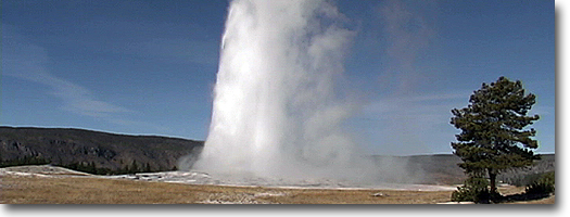
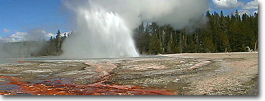
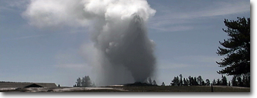
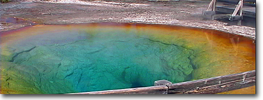
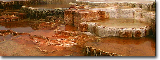
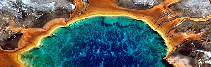
Mammoth Hot Springs Be sure to take our
online tour of the hot springs. Mammoth Hot Springs are the main attraction
of the Mammoth District. These features are quite different from thermal
areas elsewhere in the park. Travertine formations grow much more rapidly
than sinter formations due to the softer nature of limestone. As hot
water rises through limestone, large quantities of rock are dissolved
by the hot water, and a white chalky mineral is deposited on the surface.
Although visitors are sometimes confused by the rapidly shifting activity
of the hot springs and disappointed when a favorite spring appears to
have "died," it is important to realize that the location of springs
and the rate of flow changes daily, that "on-again-off-again" is the
rule, and that the overall volume of water discharged by all of the
springs fluctuates little.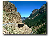
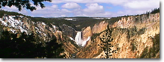
The Gardner River and Gardner River
Canyon
The North Entrance Road from Gardiner, Montana, to Mammoth Hot Springs,
Wyoming, runs along the Gardner River. The road winds into the park,
up the canyon, past crumbling walls of sandstone and ancient mudflows.
The vegetation is much thicker in the canyon than on the open prairie
down below, the common trees being Rocky Mountain juniper, cottonwood,
and Douglas-fir. Low-growing willows also crowd the river's edge in
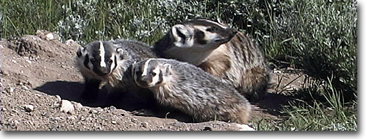
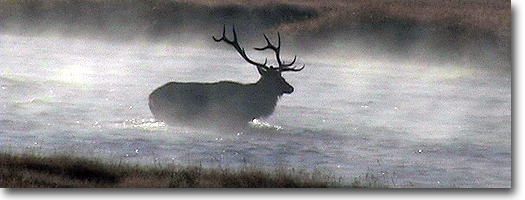
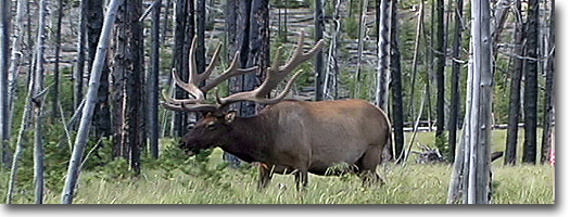
the flatter, flood-prone sections of the canyon. Watch for wildlife
in season: eagles, osprey, dippers, and kingfishers along the river
and bighorn sheep in the steeper parts of the canyon.
45th Parallel Bridge and Boiling River
A sign near where the road crosses the Gardner River marks the 45th
parallel of latitude.The 45th parallel is an imaginary line that circles
the globe halfway between the equator and the North Pole. This same
line passes through Minneapolis-St. Paul, Ottawa, Bordeaux, Venice,
Belgrade, and the northern tip of the Japanese islands. It is, here
in Yellowstone, roughly aligned with the Montana-Wyoming border.
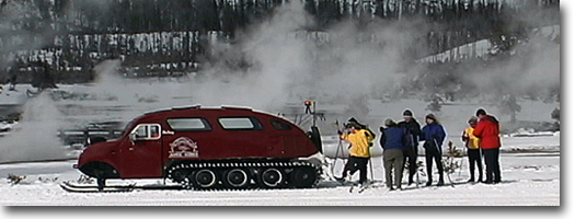
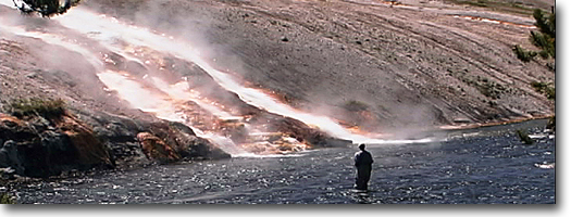
A parking area on the east side of the
road is used by bathers in the "Boiling River." Bathers must walk upstream
about a half mile from the parking area to the place where the footpath
reaches the river. This spot is also marked by large clouds of steam,
especially in cold weather. Here, a large hot spring, known as Boiling
River, enters the Gardner River. The hot and the cold water mix in pools
along the river's edge. Bathers are allowed in the river during daylight
hours only. Bathing suits are required, and no alcoholic beverages are
allowed. Boiling River is closed in the springtime due to hazardous
high water and often does not reopen until mid-summer. The Yellowstone
Park Foundation funded the Boiling River Trail Project. They are a non-profit
organization whose mission is to fund projects and programs that protect,
preserve and enhance Yellowstone National Park.
Mt. Everts
Mt. Everts was named for explorer Truman Everts of the 1870 Washburn
Expedition who became separated from his camping buddies, lost his glasses,
lost his horse, and spent the next 37 days starving and freezing and
hallucinating as he made his way through the untracked and inhospitable
wilderness. Upon rescue, he was, according to his rescuers, within but
a few hours of death. Everts never made it quite as far as Mt. Everts.
He was found near the "Cut" on the Blacktail Plateau Drive and was mistaken
for a black bear and nearly shot. His story, which he later published
in Scribner's Monthly Magazine, remains one of Yellowstone's best known,
lost-in-the-wilderness stories. It has also been published in book form,
edited by Yellowstone's archivist Lee Whittlesey under the name Lost
in the Yellowstone.
Mt. Everts is made up of distinctly layered
sandstones and shales--sedimentary rocks deposited when this area was
covered by a shallow inland sea, 70 to 140 million years ago.
Bunsen Peak
Bunsen Peak and the "Bunsen burner" were both named for the German physicist,
Robert Wilhelm Bunsen. Although most people are familiar with the "Bunsen
burner," few people know why his students gave the burner that name.
He was involved in pioneering research about geysers, and a "Bunsen
burner" has a resemblance to a geyser. His theory on geysers was published
in the 1800s, and it is still believed to be accurate. Bunsen Peak is
8,564 feet high (2,612 meters) and may be climbed via a trail that starts
at the Golden Gate. Another trail, the old Bunsen Peak road, skirts
around the flank of the peak from the YCC camp to the Golden Gate. This
old road may be used by hikers, mountain-bikers, and skiers in winter.
The peak is also interesting because it burned in the 1880s and then
again in 1988. A series of old photos show the creep of trees up Bunsen
following the 1880 fires, and the new patterns of open space created
by the fires of 1988.
|