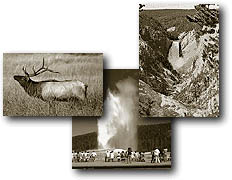
%20of%20hikingwestthumbbar.JPG)
West
Thumb is rich in history. It dates back to a romantic period at the
turn of the nineteenth century when dudes traveled in luxury. After
spending several nights at Old Faithful, they would don canvas dusters
for their stagecoach ride to West Thumb, where they stopped for lunch
and toured the basin before boarding the steamer, Zillah. The launch
then would carry them across Yellowstone Lake to the comforts of Lake
Hotel.
Until recently. West Thumb was the hub
of activity with an original Haynes photo shop and a Hamilton general
store. They were destroyed in the early 1980s and replaced with 1980s-style,
landscape-designer berms.
Grant Village is a relatively new development,
cut from pristine forest and built on three primary cutthroat spawning
streams in prime grizzly-bear habitat. It is the result of the National
Park Service's "Mission 66" projects. The first installation
at Grant Village was the very expensive marina, the pride
of the National Park Service. Within two years after installation, however,
the marina was unusable because of complete structural failure. Today,
the marina lays in ruins and still is unusable but no attempt has been
made to reclaim this site.
Because Grant Village is a relatively
new development and no thought was given to its location and layout,
this site lacks trails from the immediate area, except for the short
lakeshore walk. But outside of
Grant Village are some of Yellowstones more challenging and unusual
trails. Some wander along the Continental Divide or to large remote
backcountry lakes and others cross barren, rippled lava flows or lead
to geyser basins and waterfalls.
West Thumb Geyser Basin Trail
Length: 1.0 mile, loop.
Elevation change: Trailhead at 7,760 feet (20-foot loss).
Trailhead: Begins at the West Thumb Geyser Basin parking area.
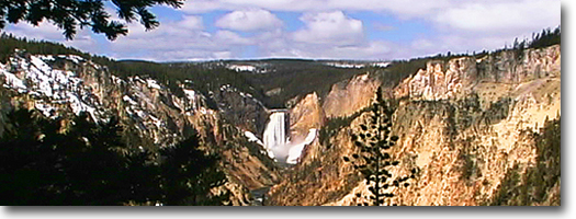
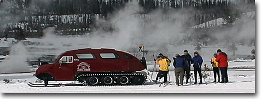
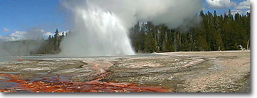
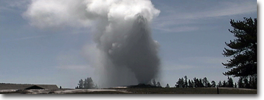
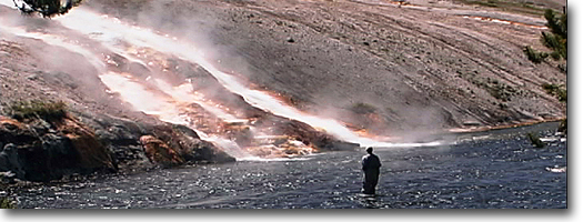
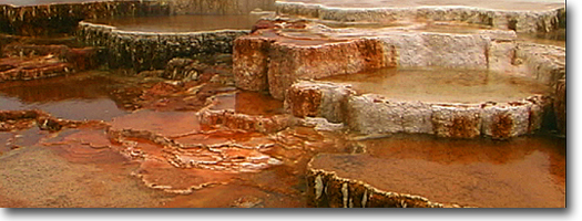
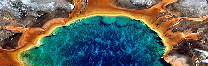
West Thumb Geyser Basin is one of the
smallest, yet concentrated, geyser basins in Yellowstone, but its location
along the shore of Yellowstone Lake ranks it as the most scenic. The
1870 Washburn Expedition gave West Thumb its name because of the thumb-like
projection of Yellow-stone Lake.
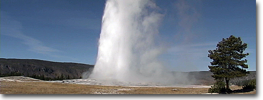
The trail begins from the parking area
and is a short figure-eight-shaped boardwalk looping through the basin
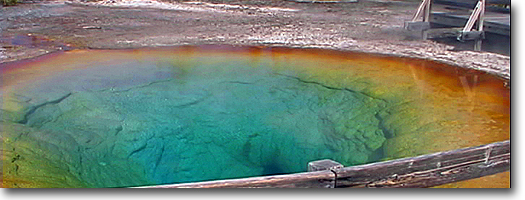
and along the shore of the lake. Fishing Cone is one of the basin's
most popular features; its location on the shoreline and its symmetrical
cone were popularized by early stories of "boiled trout."
Abyss Pool-the deepest in Yellowstone- is noted for its color and depth.
Observation Hill Trail
Length: 0.4 miles, one way.
Elevation change: Trailhead at 7,810 feet (290-foot gain).
Trailhead: Located several hundred feet south of the West Thumb Junction
on the South Entrance Road. The location is marked only by a small turnout
on the west side of the road; there are no signs. The trail heads west,
uphill from the road.
This trail was a popular short hike for
guests staying at the West Thumb cabins, which were located in what
is now a reclaimed field directly across the road from the trailhead.
In this area at the West Thumb junction were a handful of cabins, a
Hamilton General Store and one of the original, historic Haynes photo
shops. They were all torn down in the early 1980s as an effort by the
National Park Service to channel visitor interest to their new facilities
at Grant Village. The Park Service response to the outcry about removal
of West Thumb was that it was removing structures to protect the groundwater
and fragile features of the thermal basin. But the demolition and new
construction of the paved surface of the parking area and the creation
of berms, trenches and other landscaping construction altered the dynamics
of the thermal basin drastically, enough that it has never recovered.
Since the removal of the West Thumb cabins,
this trail has seen very little traffic and has become faint and somewhat
in disrepair. But for those staying in nearby Grant Village, this hike
and the Riddle Lake Trail (see Riddle Lake Trail for description) provide
the only hikes in the immediate area.
From the road, the trail leads uphill
to the west and enters a sparse lodgepole forest. After a short, steep
hike, the trail emerges at a small opening on a knoll that provides
a panoramic view of West Thumb Geyser Basin, Yellowstone Lake, Grant
Village development and, on the distant skyline, the Absaroka Range.
Grant Village Lakeshore Stroll
Length: 1.0 mile, one way.
Elevation change: Trailhead at 7,735 feet (no substantial elevation
change).
Trailhead: Located at the Grant Village Campground.
This short stroll is the only walk from
the Grant Village area. The east-shore stroll is accessible from the
amphitheater, and the trail crosses the metal swinging bridge-over an
important cutthroat spawning stream-before it descends to the lake.
From there, the trail follows the lakeshore to the abandoned marina.
The black-sand shore is composed of ground
black obsidian sand. The shore has hosted explorers, trappers and Native
Americans, whose projectile points (arrowheads) still are found occasionally
along the beach.
Another haphazard trail partially follows
the old shore-line road, removed shortly after development of Grant
Village in the early 1970s. It is a short stroll, unless the outlet
to Big Thumb Creek can be forded, or circumnavigated via the highway
bridge. In the spring water can be more than waist-deep. This creek
also is a major spawning area for cutthroat trout, which can be seen
moving upstream during spring to the small, rippled tributaries, where
they will construct redds-fish nests-in the sandy, gravel bottoms.
Riddle Lake Trail
Length: 1.75 miles, one way.
Elevation change: Trailhead at 7,980 feet (60-foot loss).
Trailhead: Riddle Lake Trailhead, located about 2.5 miles south of Grant
Village junction, on the Continental Divide.
A classic Yellowstone hike. This trail
wanders among lodgepole pines along the Continental Divide. It is unusual terrain-hummocky, yet relatively level.
In this indecisive terrain, water stands in sedge-filled bogs before
parting either to the Pacific or Atlantic drainages. Riddle Lake is
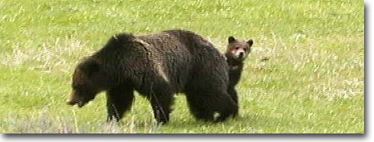
a small lake, partially covered with pond lilies and rushes and, as
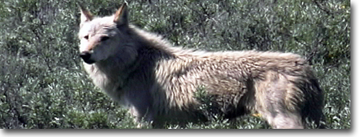
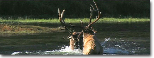
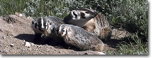
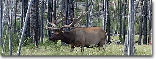
a result, provides habitat for moose, elk, bears, loons, sandhill cranes,
swans, great blue herons, and a variety of ducks. From the lake are
beautiful vistas of the Red Mountains and Mount Sheridan.
Riddle Lake once was stocked with fish
from the Yellowstone Lake fish hatchery, and the lake was a popular
fishing destination. Surprisingly, fish wintered in this small, relatively
shallow (27 feet deep) lake and survived long after fish-planting efforts
were abandoned. Because it no longer is stocked and because of heavy
fishing pressure, however, the lake no longer supports a large fish
population. Since the early 1990s, the lake has been closed to fishing.
The first known description of Riddle
Lake was written by Frank Bradley of the 1872 Hayden Survey. This "mythical
lake among the mountains" was believed by early explorers and hunters
to flow to both oceans. It was a riddle to them as to which direction
this lake actually flowed. Did it flow to the south into the Snake River
or north into the Yellowstone River? The actual outlet is not clearly
defined because water percolates and seeps through a marshy area along
the northeast shore. The drainage eventually collects and flows to Yellow-stone
Lake. This creek was discovered in 1885 by the geological Hague parties.
It solved the riddle to Riddle Lake and thus was named Solution Creek.
Lewis Channel - Shoshone Lake Trail
Length: 6.0 miles, one way.
Elevation change: Trailhead at 7,785 feet (6-foot gain).
Trailhead: Located on the western side of the South Entrance Road, just
north of Lewis Lake and 14.5 miles north of the South Entrance.
It is across from and slightly north of the Heart Lake Trailhead in
dense lodgepole pine and also is known as the Dogshead Trailhead.
This trail marks the scenic route to
Shoshone Lake. It follows the channel between Shoshone and Lewis lakes
and provides access for hikers who are following canoers up the channel. The trail begins at the Doghshead Trailhead
but splits from that trail (see Dogshead Trail for description), shortly
afterward. At this point, the trail maneuvers around the northern swampy
section of Lewis Lake, then skirts along the shore before cutting northwest
to the river channel.
Most of the trail is up and down as it
traverses ancient lava flows, but even with the irregular terrain, only
6 feet is gained overall. About
halfway along the trail is a popular diving rock at a sharp bend in
the channel. The pool at the base of the rhyolitic cliff provides a
great swimming hole on hot summer days. But the water is cold, and the
cliff itself-with its telltale whitened points-acts as a lightning rod
during thunderstorms, so avoid it on stormy afternoons. Canoers, hikers
and swimmers also should take extreme caution on the channel and lakes
in general, as lightning strikes are very common in this area.
Some areas of the trail are faint, and
there may be several parallel trails in others. This was never a properly
placed trail but was derived from repeated use. Common route finding
and directional sense are necessary when the trail becomes misleading.
The trail merges at the outlet of Shoshone
Lake with the Shoshone Lake Trail (see Shoshone Geyser Basin Trail for
description) and the Delacy Creek Trail (see Delacy Creek Trail for
description).
Dogshead Trail to Shoshone Lake
Length: 4.25 miles, one way.
Elevation change: Trailhead at 7,785 feet (6-foot gain).
Trailhead: Same trailhead as Lewis Channel access, 14.5 miles north
of the South Entrance, in a dense stand of lodgepole pine on the west
side of the South Entrance Road. It also is known as
the Dogshead Trailhead.
This trail is the preferred access to
Shoshone Lake. It is the shortest and most direct route to the lake,
though it is not as interesting as the Channel Trail. Most of the trail
is through a dense and monocultural lodge-pole pine forest with occasional
patches of burned forest from the 1988 fires.
Near the trailhead, the trail splits
in three directions. The northern trail is the Dogshead Creek Trail,
or part of the South Entrance Trail. It followed an old road and eventually
terminated at West Thumb, but it has not been maintained for decades
and now is in a state of disrepair. The old trail is still marked with
the presence of a power line. The southern trail leads to the Lewis
Channel Trail and the middle trail is the Shoshone Lake Trail. It reaches
the lake at the patrol cabin near the lakes outlet, where the trail
connects with Delacy Creek Trail (see Delacy Creek Trail for description)
of Yellowstone and constitute the largest roadless wilderness area in
the 48 contiguous states. Exploring this region properly by backpacking
or horsepacking generally requires a week or more.
The northern trail to Heart Lake requires
several river and stream fords. The first across the Snake River is
treacherous because of swift and deep water during spring and early
summer, but it becomes more manageable in late summer and fall. The
trail passes two small lakes. Basin Creek and Sheridan, before reaching
Heart Lake after about 7 miles. An additional 3 miles around the western
shore of the lake reaches Heart Lake Geyser Basin and the trail junction,
which leads to the Lewis/ Heart Lake Trailhead.
Beula Lake Trail
Length: 2.4 miles, one way.
Elevation change: Trailhead at 7,225 feet (152-foot gain).
Trailhead: Located near the inlet of Grassy Lake Reservoir on the north
side of Grassy Lake Road, which begins at Flagg Ranch. The trailhead
is marked by a small but steep parking area amid the lodgepole pines.
The trail begins with a short, steep
ascent through lodgepole pines and subalpine fir to an undulating plateau.
In early summer, the forest floor is dotted with wildflowers, including
heartleaf arnica and serviceberry. Shortly after reaching the top of
the plateau, and after about a half mile from the trailhead, is the
southern park boundary. It is marked by bright orange tree flashings
and a swath cut through the trees, which also marks the South Boundary
Trail. From that juction, most of the hike is across the plateau through
lodgepole pine. A prescribed burn (artificial burning) was conducted
by the National Park Service during the early 1990s beginning at the
boundary north. It was an unsuccessful burn and most of the down trees
were charred only on the outside. These black tree trunks now
are impervious to decay and will remain this way for centuries to come.
Beula Lake is a small forest lake, a
little more than 100 acres in surface size and about 36 feet deep. The
shoreline is sedge- or tree-lined, with the southern end forming a swampy
edge covered in pond lilies. A large beaver lodge also is located at
the southern edge. The lake is a popular destination for local Idahoans
who make the one-hour hike to take advantage of the great catch-and-release
fishing.
The lake was believed to have been barren
offish at the turn of the twentieth century. But between 1935 and 1944,
an estimated 50,000 cutthroat fry and more than a million eyed-eggs
from the Yellowstone Lake hatchery were planted in Beula Lake. The lake
offers excellent spawning grounds, and the fish have been very successful
in establishing and propagating themselves.
|